Cape Horn
Default cubes in the wild
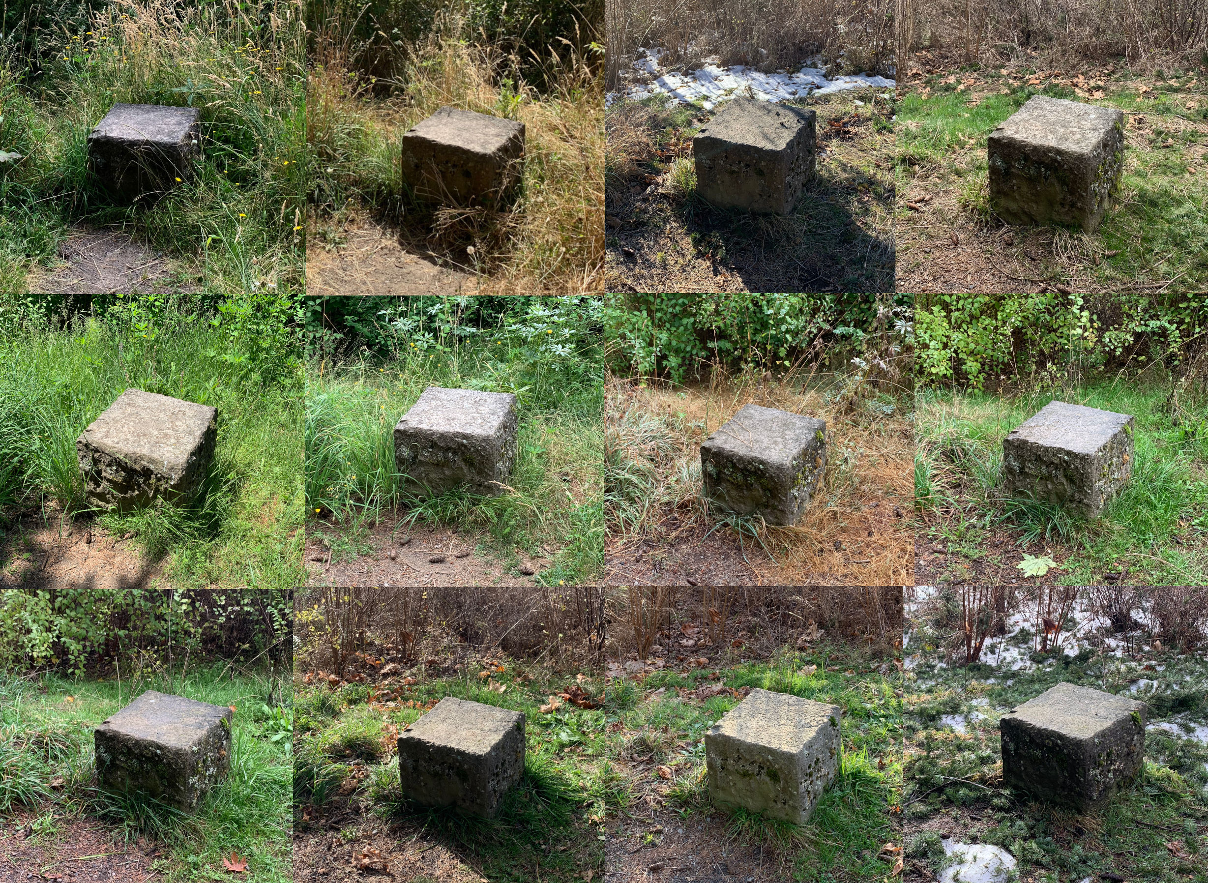

Before I started hiking a lot a few years ago, as someone who grew up in the wilds of California suburbs, I never quite realized how much vegetation changes through the year. My family would go on camping trips during holidays, but even when we would go to the same places, all the plants would be the same, because it was usually the same time of year!
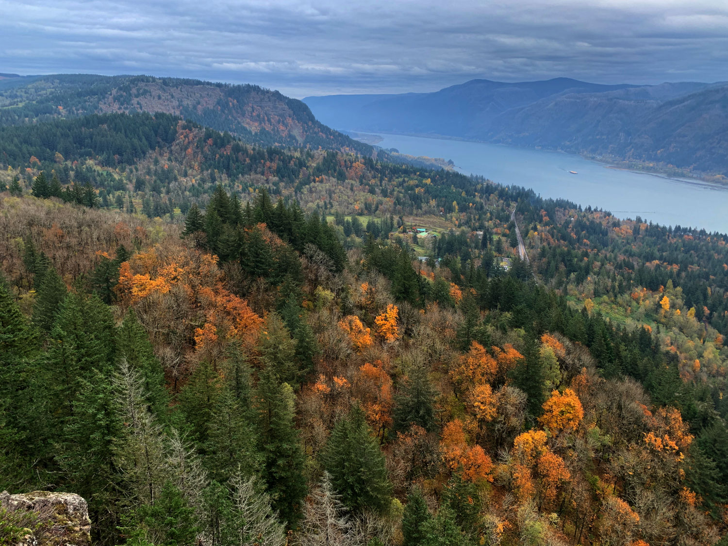
Eastward view from one of Cape Horn’s viewpoints
One trail where I’ve gotten to see the seasons change is Cape Horn, right on the edge of the Columbia River Gorge. Being somewhat close to town, it doesn’t take me long to get there, so I end up going there a lot. For a trail that’s only about 7 miles, except February to July 15 when part of the loop is closed for peregrine falcon nesting, it packs in a lot of features, such as cliffs, river panoramas, a waterfall, open fields, mountain views. Kind of a good preview of everything that you find with greater drama further out in the Gorge, or south by Mt. Hood, or north by Mt. St. Helens.

There is a slightly boring mile and a half of road walking if you do the whole loop, but there’s rarely a car, and it takes you through some pleasant farm land, with a great view of the cliffs that surround the freeway. I tend to do this section first to get past it while I’m fresh, as it can be a bit of a punishment especially during the summer, when the asphalt really bakes you.
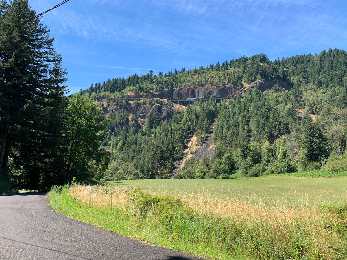
Those freeway pillars are where that portion was accidentally blown up during construction.
When the freeway was originally being built, there was an explosive miscalculation, which blew out a huge hole in the freeway, with debris sliding all the way down to the Columbia River, making a wave that splashed all the way to the Oregon side! No humans died, but six hogs were killed, a railroad buried under 15 feet of rock, and a steamboat dock taken out. When the road was later completed, it was covered with a wooden tunnel locals called the Shed, to protect cars from rocks falling off the cliffs above. This was later replaced by netting in the 1960s.
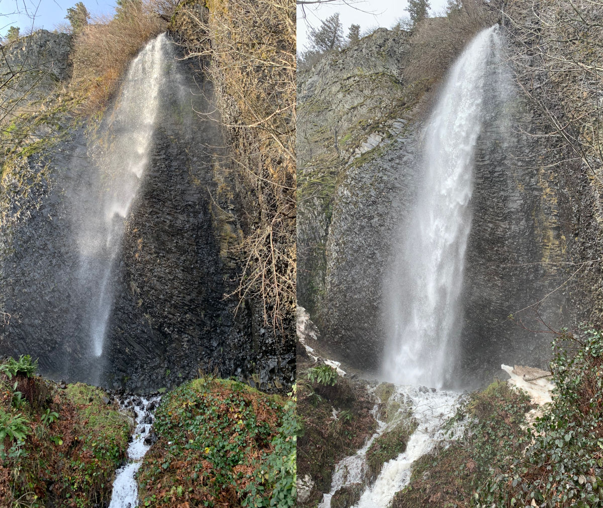
Cape Horn Falls in mid fall, and later in winter. Alas the waterfall is in the closed section February 1 through July 15.
Once off the road and up into the hills, you first pass a pleasant waterfall, which is actually just one part of a larger sequence of waterfall stretching up the cliffs. The trail winds up the hill, past some talus covered slopes, past some trees where you can sometimes see large osprey nests, past the Cigar Rock view, a spot right next to a huge cliff drop straight down to the riverside.


From there, the trail turns slightly inland, getting up into tall big leaf maples and firs. During the right season, you can also find dense bushes of deep blue larkspur. The trail winds up the hill, under the freeway, and past some horribly dense, thorny invasive himalayan blackberry thickets that are very common all over the area, especially near roads.

Vine maples and some cedars greet you further up, until you come to the biggest viewpoint, built as a large stone circle with four big trees framing the view eastward up the Columbia River. From here, you pass more farmland, and cross a road, which is also a future access point for the trail. See the Friends of the Gorge for more information about that!

Past the road, you wind around the north side, where sometimes there’s lingering snow in the winter, plus great views of the mountains further north, such as Silver Star Mountain. Eventually, you come to the summit, with a fabulous wide view of the river. Then, it’s an easy descent back to the trailhead, where you can encounter, depending on the time of year, various mushrooms, deep blue larkspur, Columbia lilies, and a field of touch-me-nots, though I can never quite time it right to be there when I can touch the touch-me-nots, whose seed pods explode! ..And many other flowers in the spring!


As I write this in March, 2025, Cape Horn is administered by the US Forest Service, one of the many federal agencies now under severe, damaging attack by the current administration and its total contempt for public servants, total contempt for very concept of public land that anyone rich or poor can go to and enjoy. Also Washington state is voting on whether to defund the Columbia River Gorge Commission. Please get involved however you can to ensure that the Gorge and all of our public parks will continue to be our legacy, protected for the next generations. You might start with the Friends of the Gorge, or the Cape Horn Conservancy. Just remember, as a sign at the trailhead says, there is no poop fairy!
Here’s some more bloomscrolling from the trail to offset the uncertain future:
Larkspur!

Western Columbine!

Oregon iris!

Purple foxglove!

Columbia lily!


Dew! Ok so not a bloom, but I still think it’s pretty
More about Cape Horn’s history here:
- Friends of the Columbia Gorge trail page: https://gorgefriends.org/hike-the-gorge/cape-horn.html
- Tale of the blasting at Cape Horn: http://www.columbiagorge.org/wp-content/uploads/2013/06/Tale_of_Blasting_of_Cape_Horn.pdf
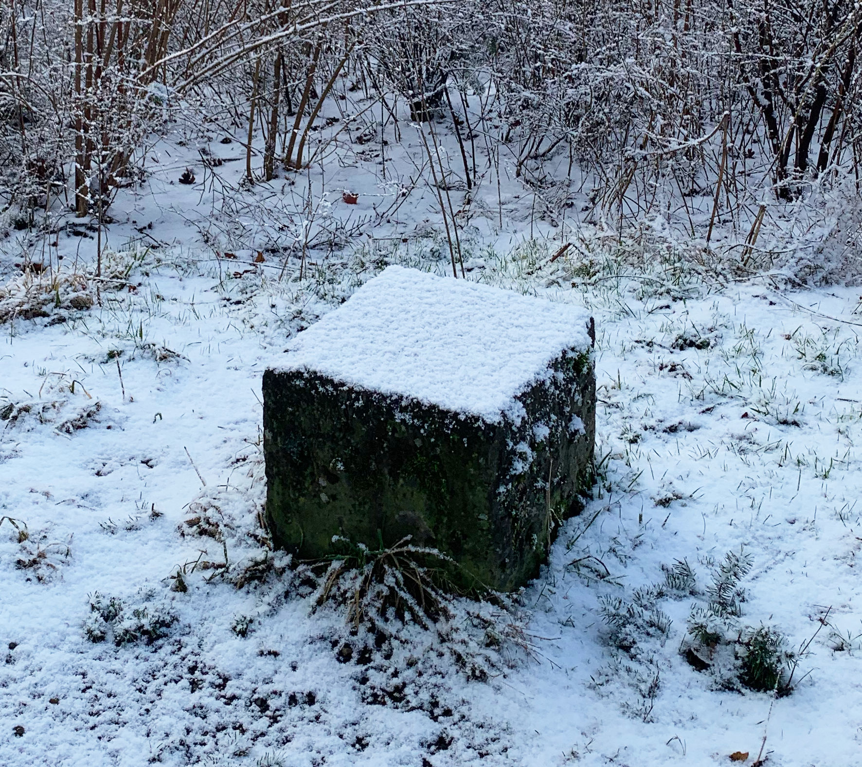
Last but not least, a snowy default cube braving the winter.